The Indian Space Research Organisation has formally announced a new satellite launch mission scheduled for later this year, marking a major step forward in India’s earth-observation, climate-monitoring and disaster-management capabilities. Senior officials confirmed that the satellite, developed under the Earth Observation Satellite (EOS) programme, incorporates next-generation optical and thermal sensors designed to enhance India’s ability to assess environmental changes and support national planning initiatives.
The mission announcement comes at a time when climate-driven weather disruptions, agricultural pressures and coastal vulnerabilities require rapid-response space-based data. ISRO emphasised that the new satellite will integrate high-resolution imaging with advanced spectral analysis tools, enabling more accurate mapping for agriculture, forestry, disaster relief and urban development. This will also support state agencies in refining early-warning systems during floods, cyclones, forest fires and drought cycles.
A Strategic Leap for National Earth-Observation Capacity
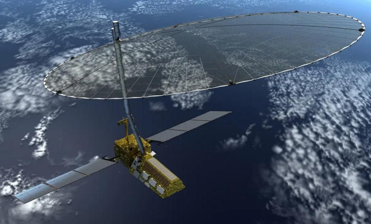
According to ISRO, the upcoming satellite will operate in a sun-synchronous orbit at an altitude of approximately 650 to 700 kilometres, enabling consistent daytime coverage across the Indian subcontinent. Engineers involved in the project noted that the satellite carries a multi-band imaging suite capable of capturing sub-meter spatial resolution, a significant improvement over earlier generations of domestic earth-observation platforms.
Officials at the Space Applications Centre confirmed that the new sensor architecture will strengthen India’s geospatial analytics capacity by providing sharper land-use, hydrological and atmospheric data. The satellite’s radiometric accuracy will help refine critical datasets used by central ministries, including those responsible for agriculture, water resources, environmental regulation and infrastructure planning.
The mission also aligns with India’s strategy to expand its earth-observation fleet to over 20 operational satellites by the end of the decade, allowing better monitoring of coastline erosion, Himalayan glacier behaviour, river-basin dynamics and air-quality movements. ISRO scientists indicated that the satellite would operate with a lifespan of five to seven years, depending on in-orbit health and fuel optimisation performance.
Advanced Sensors and Data Systems
The satellite’s imaging payload includes enhanced multispectral and hyperspectral sensors designed to provide richer data for climate modelling and environmental analytics. ISRO engineers explained that these new capabilities will support precision agriculture initiatives by helping states monitor crop health, soil moisture variation and localised drought stress.
In addition to optical payloads, the satellite integrates thermal infrared sensors that allow heat-mapping of urban centres, industrial zones and forest regions. The data will support fire-detection operations and track temperature changes affecting biodiversity zones. Senior officials confirmed that the ground-station architecture has been upgraded with improved data-processing pipelines, enabling faster data dissemination to scientific communities and government agencies.
According to the National Remote Sensing Centre, the satellite’s data packages will be integrated into national governance platforms that provide early warnings for extreme weather events. This integration reduces the time between data capture and deployment of alerts, enabling faster mobilisation of emergency teams in coastal and flood-prone regions.
Disaster Preparedness and Climate Monitoring Frameworks
Government representatives today highlighted the satellite’s role in bolstering India’s disaster-response infrastructure. Over the past decade, the country has witnessed rising incidents of extreme weather, including intensified cyclones in the Bay of Bengal and Arabian Sea, heatwaves across central India, and repeated flood cycles in northeastern and Himalayan states.
The new earth-observation mission is expected to enhance India’s forecasting systems by feeding real-time data into disaster-management networks. This includes better modelling of wind patterns, cloud formations, aerosol movements and land-surface changes during emergencies. Officials from the Ministry of Earth Sciences noted that the satellite will also help track glacier retreat rates and snowpack dynamics, critical for river-basin management and hydropower stability in northern India.
In addition to national concerns, the satellite will support international environmental commitments by enabling India to share regional data with neighbouring countries during major weather events. Officials pointed out that the mission complements India’s role in global climate initiatives, including collaborative forecasting and transboundary disaster-response coordination.
Industry Partnerships and India’s Expanding Space-Technology Ecosystem
The satellite mission reflects India’s evolving collaboration model between the public sector and emerging private space enterprises. Several components of the satellite platform were developed with contributions from domestic aerospace firms under ISRO’s commercial partnerships programme. Officials highlighted that the assembly and subsystem integration work has contributed to building India’s industrial capacity in advanced optics, sensor engineering and satellite bus manufacturing.
This mission also aligns with India’s broader vision of becoming a global satellite-data provider. With demand for high-resolution imagery rising across sectors from insurance and agriculture to urban planning and mineral exploration, the new satellite will strengthen the country’s competitiveness in the global remote-sensing market.
India’s private space sector has grown significantly since regulatory reforms expanded opportunities for startups and manufacturing firms. The upcoming launch showcases how domestic innovation and commercial partnerships are now becoming core elements of India’s space-technology ecosystem, complementing ISRO’s scientific leadership.
Conclusion
ISRO’s announcement of the new satellite launch marks a significant milestone in India’s advancement of earth-observation capabilities. With enhanced imaging precision, expanded environmental-monitoring tools and strengthened disaster-response alignment, the mission has the potential to transform national planning and climate-resilience programmes.
As the satellite undergoes final integration and testing ahead of its scheduled launch later this year, policymakers and scientific organisations anticipate substantial improvements in the quality and speed of vital geospatial data. The mission stands as another example of India’s accelerating progress in space technology and its growing role in global earth-observation systems.